The Col du Tourmalet is officially shut from "our" direction, because the road was washed away last year and it still being replaced. However today is a Monday Bank holiday here, so we reckon it may be possible to get through the roadworks as they won't be working. So we set off, first trying a little farm road as an alternative but after only 200 metres find not only has the road been washed away but replaced by lorry sized boulders. We turn back onto the main route. The two villages we pass through, Esquièze and Barèges, have no top surface left on their roads, and many side roads have been destroyed. We had not realised the scale of the destruction. About half the small bridges to side roads are destroyed, only really old stone bridges and ancient stone barns and farms have survived unscathed. More recent buildings were just washed away entirely, the occasional foundation or end wall showing where they had stood. From here on up where the road had been totally swept away there are new tarmac sections, but where only the surface is destroyed these are not yet repaired, so are very rough. As the road climbs we are overtaken by a few carbon-bikers and a several groups of motor bikers - blissfully hardly any cars. Signs read "Tourmalet Fermé", but we ignore them. After the closed ski-lift station the road steepens and we are surrounded by high mountain peaks and big patches of snow. Full waterfalls are spectacular on both sides.

The road surface worsens, only one bike in sight. A barrier saying "Route Barré" is easily passed.
Water is now coursing down the full width of the road from snow melt streams, bringing with it gravel. Fresh rock falls have to be negotiated. An enormous pylon that supported the ski lift above us has been knocked sideways by a giants blow. Looking up we can see two more enormous empty hairpin bends, but not the summit, so we still don't know if we can get through. At 2000m there the are very strong wind gusts, water rushing across the whole road, and no top surface remaining. The side crash barrier has been washed away entirely so we are a bit nervous about being blown over the edge as there's a big drop. Three German motor bikers stop with us to admire the view of the valley we have just come up from, and the surrounding snow dazzling in the bright sun.

Then one last hairpin bend, a very steep climb through temporary barriers that again state "Route Barré", and there is the sight so familiar from photos on the internet, the enormous metal statue of a cyclist, and the Tourmalet summit height sign, confirming 2115 m.


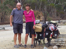
I am sure it is rare, but we had it to ourselves for a while to take photos, and then were joined by a few motor bikers and a couple of Brits amazingly carrying full panniers. We go over the top for the view down the other side, but is is softer with green meadows, so we return to "our" side and the snowy peaks, to shelter from the very strong wind, eat a baguette and venison pâté picnic, before putting on gloves and jackets to start back down.

Then taking care on rock strewn hairpins, and very gingerly through the rushing waters. Five hours up, 1 and 3/4 hrs back down. Hardly a cloud in the sky all day. Sitting on our balcony eating olives with a glass of wine to celebrate before enjoying one of Madam's wonderful 5 course meals, I chase away a lizard away who is running into our room, then watch a red kite soaring near our high balcony. A perfect day.

Miles to date:- 1763
Location:Argeles-Gazost to Col Du Tourmalet
